
Chapter XXIPatriarchal AgeאבותJacob
גלעד
Mount Gilead
The heap of witness
1556 BCEHebrew year 2205traditionalב׳ר״ה
יִצֶף ה׳ בֵּינִי וּבֵינֶךָ כִּי נִסָּתֵר אִישׁ מֵרֵעֵהוּ׃
“The LORD watch between me and thee, when we are absent one from another.”
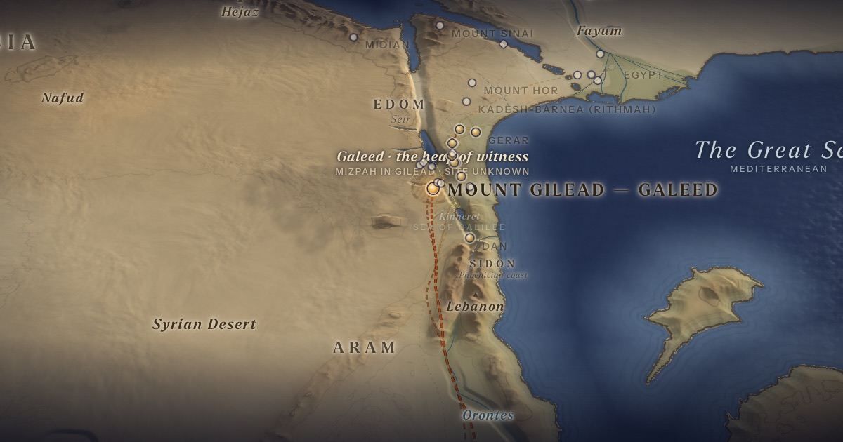
Jacob slips away with his wives, children and flocks while Laban is shearing his sheep. He crosses “the River” — the Euphrates — and heads for the highlands of Gilead. Laban overtakes him there. They part with a covenant, marking the boundary with a heap of stones: Galeed in Hebrew, Yegar-sahadutha in Aramaic.
Location
Gilead is the highland east of the Jordan in north-western Jordan. Galeed and Mizpah cannot be located.
- Mount Gilead — Galeedגִּלְעָד — Highlands of north-western JordanTextually identified 32.30° N, 35.80° EA heap of stones as witness between Jacob and Laban.
The journey
Haran → Mount Gilead≈ 700 km
Across the Euphrates and south through Syria. Roughly 35–59 days at the pace of flocks. Route conjectural.
Distances are estimates along plausible ancient corridors, not measured routes.
Chronology
Jacob leaves Laban after twenty years (Gen. 31:41).
Biblical Narrative
Rachel steals her father’s teraphim (31:19). Laban pursues and searches the tents; Rachel hides the images in a camel’s saddle and sits on them (31:33–35). Jacob recounts his twenty years of labour (31:38–42). They make a covenant and eat on the heap of stones; Laban names it in Aramaic and Jacob in Hebrew — both meaning “heap of witness” (31:44–48).
Geography
Gilead’s wooded hills, rising above 1,000 m, were famous for balm (Jer. 8:22) and pasture. For Jacob, coming from the north, they are the first highlands of the land promised to his fathers. Haran to Gilead is roughly 700 km; Laban’s seven-day pursuit (31:22–23) implies a remarkable pace, as commentators have long observed.
Historical Context
The bilingual naming — Aramaic Yegar-sahadutha beside Hebrew Galeed (31:47) — is the only Aramaic in the Torah, and reflects the frontier between Aram and Israel that ran through Gilead in the monarchic period.
Jewish Tradition
Rashi (on Gen. 31:52) reads the heap as a boundary neither side may cross “for harm,” though trade may pass. The Passover Haggadah reads “an Aramean would have destroyed my father” (Deut. 26:5) as referring to Laban.
Traditional and rabbinic interpretation — presented as tradition, not as archaeological evidence.
Identification
- What the text says
- “The mountain of Gilead” (31:21, 23, 25); Galeed and Mizpah (31:47–49).
- Scholarly proposals
- Gilead is the highland on either side of the Jabbok, south of the Yarmuk — the region is certain.
- What remains uncertain
- Galeed and Mizpah are unknown; several Transjordanian places bore the name Mizpah (“watchpost”).
Sources
Hebrew Bible
- Genesis 31:17–32:1 (Eng. 31:17–55)בראשית ל״א:י״ז–ל״ב:א׳
Verse numbers follow the Hebrew (Masoretic) text. Links open the text in Hebrew and English on Sefaria.
Jewish tradition & interpretation
Interpretive tradition — not archaeological evidence.
- Rashi (R. Shlomo Yitzḥaki, 1040–1105), Commentary on the Torah. — on Gen. 31:52רש״י על בראשית ל״א:נ״ב
Modern scholarship
- Nahum M. Sarna, The JPS Torah Commentary: Genesis (Philadelphia: Jewish Publication Society, 1989).
Atlases & reference works
- Burton MacDonald, “East of the Jordan”: Territories and Sites of the Hebrew Scriptures (Boston: American Schools of Oriental Research, 2000).
- Yohanan Aharoni, The Land of the Bible: A Historical Geography, rev. ed., trans. A. F. Rainey (Philadelphia: Westminster, 1979).
Translation
- The Holy Scriptures According to the Masoretic Text (Philadelphia: Jewish Publication Society of America, 1917). Source of the short quotations on each card (public domain). Verse numbers follow the Hebrew text.